Spring Showers Deliver Green and Wild Flowers
 |
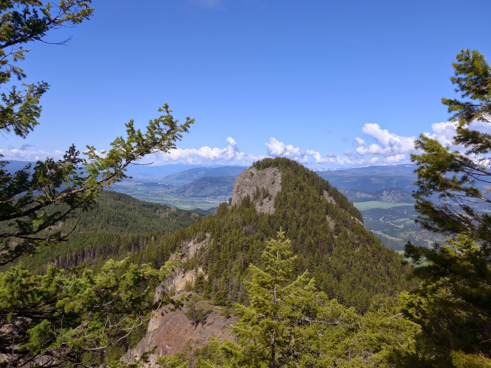
| panoramic view from Camels Hump |
 |
| Chocolate Lilly |
 |
| Shooting Star photo by Colin Baxter |
On Mothers Day (May 10) we hiked Camel's Hump, a double peak southeast of Lumby, off Creighton Valley Road. As you drive east through the Coldstream Valley, it is easy to recognize but it is often confused with a closer triple peak south of Lavington called Blue Nose.
The greatest challenge of Camel's Hump is the drive up to the trail-head after you turn off Creighton Valley Road. A vehicle with high clearance is essential and 4 wheel drive is advisable. The 6 km trail takes you up to the first peak and the lush vista of the Creighton Valley. Here you see the second hump, an impressive outcrop of basaltic lava.
 |
| Camels Hump |
An early season hike that the VOC includes every year is up East Hill. The trail starts only 10 minutes from downtown Vernon. From the hillside you can see the north end of Kalamalka Lake and the Coldstream Valley which is that fresh spring-green for only a few weeks before the sporadic spring rains dissolve into the arid sunny summer.
Every time I have been up East Hill, the wind blows and it is not unusual to see a hanglider or paraglider circling above the valley, drifting on the thermal currents. The Lavington/Lumby area has several good launch sites and has hosted many competitions.
Another hike a bit farther from Vernon that is usually scheduled in May is up Sugarloaf Mountain. The trail-head is about an hour from Vernon, off of Westside Road. Apparently this round-topped hill standing by itself on the west side of Okanagan Lake looks like a sugarloaf. I did not know what a sugarloaf was, so looked it up and here is what Wikipedia had to say:
A sugarloaf was the traditional form in which refined sugar was produced and sold until the late 19th century when granulated and cube sugars were introduced. A tall cone with a rounded top was the end-product of a process that saw the darkmolasses-rich raw sugar, refined into white sugar.[1]
This is only a 5 km hike but is considered moderately steep, taking about two hours for the round trip. It looks down on the valleys of Whiteman Creek and Bouleau Creek eventually coming to a cliff edge that offers a great view of Okanagan Lake to the south which is a spectacular spot for lunch.
 |
| Okanagan Lake, looking south from Sugarloaf Mountain |
 |
| meadow arnica |
 |
| fairy slipper (calypso orchid) photo by Colin Baxter |
